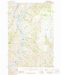
1987 Map of Oxbow
USGS Topo · Published 1987About this map
Snake River Oxbow Reservoir dominates this landscape along the border of Oregon and Idaho, where the river's dramatic curve at The Oxbow was transformed by hydroelectric development. The settlement of Oxbow serves as the focal point for regional infrastructure, supported by a Substation, Gaging Station, and the massive Oxbow Dam. This 1980s-era survey documents the industrial footprint of power generation integrated into the steep canyon terrain of the Payette National Forest.
Find a feature on this map
43 named features on this map. Tap any name to fly to it.
Don’t see what you’re looking for? This feature index may not catch every label — zoom into the map to look around manually.
Map Details
Editions of this 1987 Oxbow Map
This is the sole edition of this map. No revisions or reprints were ever made.
Other maps of this area

1920 · Seven Devils Mining District
USGS Topo · 1:48,000

1955 · Baker
USGS Topo · 1:250,000

1955 · Grangeville
USGS Topo · 1:250,000

1957 · Cuprum
USGS Topo · 1:62,500

1957 · Homestead
USGS Topo · 1:62,500

1957 · Copperfield
USGS Topo · 1:62,500

1957 · Hornet
USGS Topo · 1:62,500

1959 · Baker
USGS Topo · 1:250,000

1959 · Grangeville
USGS Topo · 1:250,000

1980 · McCall
USGS Topo · 1:100,000