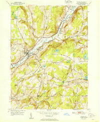
1951 Map of Oxford
USGS Topo · Published 1951About this map
The Chenango River valley serves as the central artery for this mid-century survey of Chenango County, where transportation history is etched into the landscape. Parallel to the river, the traces of an Abandoned Canal and the Oxford Sta rail stop represent layers of industrial development that shaped Oxford. The presence of the Womans Relief Corps Home near the village center highlights a significant social institution of the era, while the surrounding hills are dotted with rural landmarks like Northrups Corners and Walker Corners.
Find a feature on this map
60 named features on this map. Tap any name to fly to it.
Don’t see what you’re looking for? This feature index may not catch every label — zoom into the map to look around manually.
Map Details
Editions of this 1951 Oxford Map
This is the sole edition of this map. No revisions or reprints were ever made.
Other maps of this area

1902 · Coventry
USGS Topo · 1:62,500

1903 · Norwich
USGS Topo · 1:62,500

1904 · Oxford
USGS Topo · 1:62,500

1910 · New Berlin
USGS Topo · 1:62,500

1912 · New Berlin
USGS Topo · 1:62,500

1915 · Unadilla
USGS Topo · 1:62,500

1918 · Unadilla
USGS Topo · 1:62,500

1943 · Sidney
USGS Topo · 1:24,000

1943 · Holmesville
USGS Topo · 1:24,000

1943 · Norwich
USGS Topo · 1:24,000