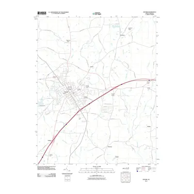
2010 Map of Oxford
USGS Topo · Published 2010About this map
Oxford serves as the central hub of this 2010 topographic survey, anchored by its core street grid and civic landmarks like the Oxford Post Office. The landscape radiates outward into Granville County, showing a mix of established residential areas, memorial grounds such as Elmwood Cemetery, and industrial infrastructure. The presence of the Henderson-Oxford Airport to the northeast and the Oxford Outer Loop underscores the modern transportation corridors that define the region.
Find a feature on this map
67 named features on this map. Tap any name to fly to it.
Don’t see what you’re looking for? This feature index may not catch every label — zoom into the map to look around manually.
Map Details
Editions of this 2010 Oxford Map
This is the sole edition of this map. No revisions or reprints were ever made.
Other maps of this area

1943 · Creedmoor
USGS Topo · 1:62,500

1944 · Creedmoor
USGS Topo · 1:62,500

1953 · Oxford
USGS Topo · 1:62,500

1953 · Greensboro
USGS Topo · 1:250,000

1954 · Greensboro
USGS Topo · 1:250,000

1962 · Greensboro
USGS Topo · 1:250,000

1966 · Greensboro
USGS Topo · 1:250,000

1966 · Oxford
USGS Topo · 1:62,500
1970 · Townsville
USGS Topo · 1:24,000

1970 · Henderson
USGS Topo · 1:24,000