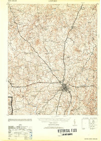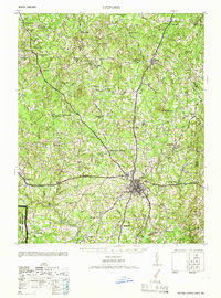
1966 Map of Oxford
USGS Topo · Published 1966About this map
The town of Oxford serves as the hub for this mid-century survey of Granville County, where a dense network of country roads connects scattered crossroads communities and agricultural settlements. The landscape is defined by the headwaters of the Tar River and a multitude of small creeks such as Grassy Creek and Fishing Creek. Transportation is anchored by the crossing of the Southern Railway and Seaboard Railroad lines, which supported the movement of goods through the region during this era of tobacco and textile prosperity.
Find a feature on this map
74 named features on this map. Tap any name to fly to it.
Don’t see what you’re looking for? This feature index may not catch every label — zoom into the map to look around manually.
Map Details
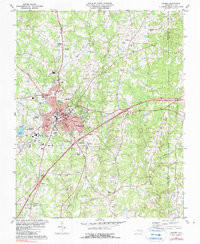
Editions of this 1966 Oxford Map
This is the sole edition of this map. No revisions or reprints were ever made.
Historical Maps of Oxford Through Time
8 maps found