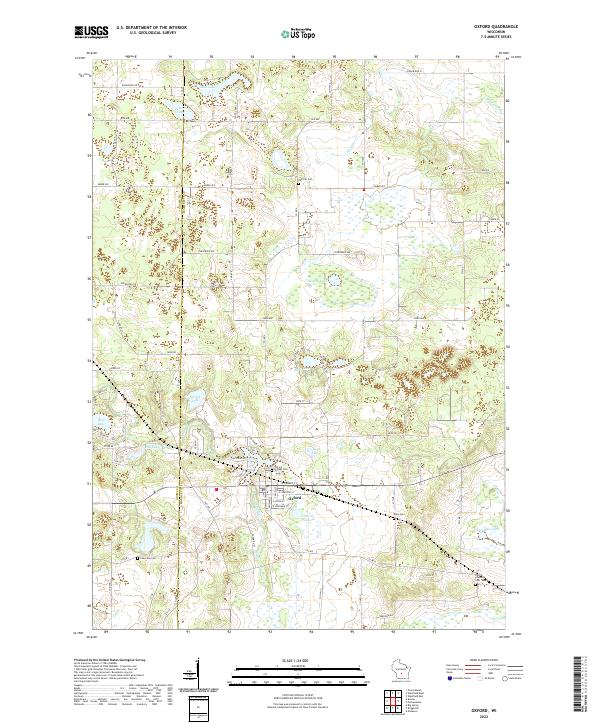
2022 Map of Oxford
USGS Topo · Published 2022About this map
Oxford serves as the central hub of this landscape, situated along the banks of Oxford Lake and near the winding course of Neenah Cr. The area is defined by a complex network of glacial kettle lakes and wetlands, including Wolf Lake, Fenner Lake, and the expansive Swamp Lake. This terrain has historically influenced local development, with road systems like Co Rd D and Co Rd I navigating around these water bodies and through the timbered sections of the region.
Find a feature on this map
49 named features on this map. Tap any name to fly to it.
Don’t see what you’re looking for? This feature index may not catch every label — zoom into the map to look around manually.
Map Details
Editions of this 2022 Oxford Map
This is the sole edition of this map. No revisions or reprints were ever made.
Other maps of this area

1902 · Portage
USGS Topo · 1:62,500

1902 · Briggsville
USGS Topo · 1:62,500

1957 · Madison
USGS Topo · 1:250,000

1958 · Briggsville
USGS Topo · 1:62,500

1960 · Madison
USGS Topo · 1:250,000

1961 · Oxford
USGS Topo · 1:62,500

1961 · Montello
USGS Topo · 1:62,500

1962 · Portage
USGS Topo · 1:62,500
1975 · Big Spring
USGS Topo · 1:24,000
1975 · Briggsville
USGS Topo · 1:24,000