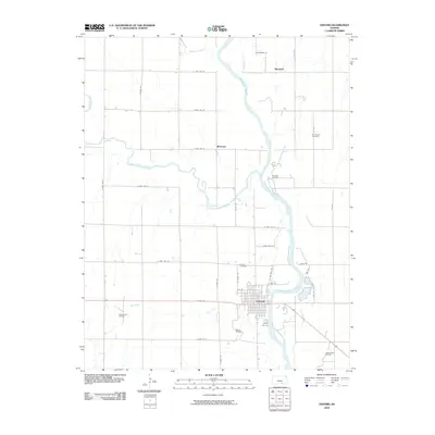
2010 Map of Oxford
USGS Topo · Published 2010About this map
Oxford sits at a strategic bend in the Arkansas River, serving as a central hub where the waterway meets the Ninnescah River. This landscape is defined by its industrial layers and rural layout, with the town’s grid appearing alongside active energy extraction zones like the Oxford Oil Field and the Churchill Oil Field. The confluence of rivers shaped the early development here, evidenced by the presence of a Mill-Race flowing parallel to the Arkansas.
Find a feature on this map
39 named features on this map. Tap any name to fly to it.
Don’t see what you’re looking for? This feature index may not catch every label — zoom into the map to look around manually.
Map Details
Editions of this 2010 Oxford Map
This is the sole edition of this map. No revisions or reprints were ever made.
Other maps of this area

1890 · Wellington
USGS Topo · 1:125,000

1955 · Udall
USGS Topo · 1:24,000

1955 · Belle Plaine
USGS Topo · 1:24,000

1955 · Mulvane
USGS Topo · 1:24,000

1955 · Wichita
USGS Topo · 1:250,000

1958 · Wichita
USGS Topo · 1:250,000

1964 · South Haven NE
USGS Topo · 1:24,000

1964 · Dalton
USGS Topo · 1:24,000

1965 · Adamsville
USGS Topo · 1:24,000
1965 · Hackney
USGS Topo · 1:24,000