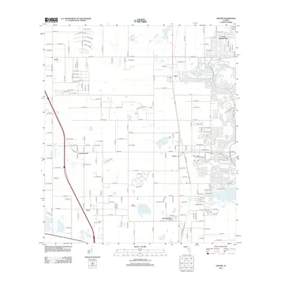
2012 Map of Oxford
USGS Topo · Published 2012About this map
Oxford and its neighboring communities are captured in this 2012 survey, revealing a landscape defined by residential expansion and rural tradition. The map highlights several small settlements including Royal, Pedro, and Dallas, alongside the sprawling development of Orange Blossom Hills. Local history is anchored by sites like Royal Memorial Cem, Crum Cem, and Pine Level Cem, which provide essential points for genealogical research. The transition from established community centers to newer residential layouts is evident in the dense street networks contrasting with the open grounds of Moreland Park and Long Hammock. Recreation and water resources are represented by Camp Wildwood and Gator Pond, while local aviation is served by Dallas Airport and Norton Airport. This document details the infrastructure and land use during a period of significant growth in the region.
Find a feature on this map
120 named features on this map. Tap any name to fly to it.
Don’t see what you’re looking for? This feature index may not catch every label — zoom into the map to look around manually.
Map Details
Editions of this 2012 Oxford Map
This is the sole edition of this map. No revisions or reprints were ever made.
Other maps of this area

1893 · Panasoffkee
USGS Topo · 1:62,500

1895 · Panasoffkee
USGS Topo · 1:62,500

1895 · Ocala
USGS Topo · 1:62,500

1954 · Gainesville
USGS Topo · 1:250,000

1954 · Daytona Beach
USGS Topo · 1:250,000

1955 · Plant City
USGS Topo · 1:250,000

1955 · Orlando
USGS Topo · 1:250,000

1957 · Orlando
USGS Topo · 1:250,000

1958 · Orlando
USGS Topo · 1:250,000

1958 · Daytona Beach
USGS Topo · 1:250,000