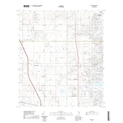
2021 Map of Oxford
USGS Topo · Published 2021About this map
Oxford and the surrounding central Florida landscape are captured in this 2021 study, revealing the dense residential growth and historic pockets north of Wildwood. The boundary between Marion and Sumter counties bisects a region characterized by modern development like Orange Blossom Hills and the established communities of Dallas and Royal. Small family and community graveyards such as Crum Cem, Pine Level Cem, and the Royal Memorial Cem provide a glimpse into the area's genealogical roots amidst rapid suburban expansion. The CSX Transportation line serves as a central artery through the corridor, while the shores of Lake Weir in the northeast and Lake Miona in the southeast ground the topography. Small landmarks like Norton Airport and the New Covenant United Methodist Church Cem further anchor this 21st-century portrait of a changing landscape.
Find a feature on this map
162 named features on this map. Tap any name to fly to it.
Don’t see what you’re looking for? This feature index may not catch every label — zoom into the map to look around manually.
Map Details
Editions of this 2021 Oxford Map
This is the sole edition of this map. No revisions or reprints were ever made.
Other maps of this area

1893 · Panasoffkee
USGS Topo · 1:62,500

1895 · Panasoffkee
USGS Topo · 1:62,500

1895 · Ocala
USGS Topo · 1:62,500

1954 · Gainesville
USGS Topo · 1:250,000

1954 · Daytona Beach
USGS Topo · 1:250,000

1955 · Plant City
USGS Topo · 1:250,000

1955 · Orlando
USGS Topo · 1:250,000

1957 · Orlando
USGS Topo · 1:250,000

1958 · Orlando
USGS Topo · 1:250,000

1958 · Daytona Beach
USGS Topo · 1:250,000