1987 Map of Oxman
USGS Topo · Published 1987About this map
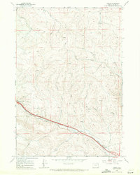
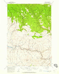
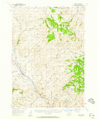
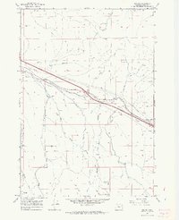
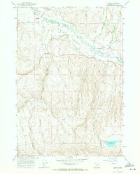
Pleasant Valley and Oxman anchor the southern reaches of this Baker County landscape, situated along the vital transportation corridor of the Union Pacific railroad. The geography is defined by a dense network of drainages including Ritter Creek, Pritchard Creek, and Alder Creek, which carve through the terrain toward the lower elevations of the Straw Ranch Low. A complex system of jeep trails and older trails spiderwebs across the northern hills, suggesting a history of land use tied to livestock and resource extraction.
Find a feature on this map
28 named features on this map. Tap any name to fly to it.
Don’t see what you’re looking for? This feature index may not catch every label — zoom into the map to look around manually.
Map Details
Editions of this 1987 Oxman Map
This is the sole edition of this map. No revisions or reprints were ever made.
Other maps of this area

1901 · Baker City
USGS Topo · 1:125,000

1915 · Pine
USGS Topo · 1:125,000

1955 · Baker
USGS Topo · 1:250,000
1957 · Sparta
USGS Topo · 1:62,500
1957 · Durkee
USGS Topo · 1:62,500

1959 · Baker
USGS Topo · 1:250,000

1967 · Virtue Flat
USGS Topo · 1:24,000
1967 · Encina
USGS Topo · 1:24,000
1967 · Keating
USGS Topo · 1:24,000
1967 · French Gulch
USGS Topo · 1:24,000