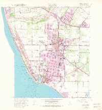
1949 Map of Oxnard
USGS Topo · Published 1968About this map
The Old Olivas Adobe stands near the Santa Clara River, anchoring a coastal landscape where agricultural roots meet post-war suburban and military expansion. This survey shows the core of Oxnard during a transitional period, featuring a dense network of local schools like the Wilson Sch and Brittell Sch. The coastal strip is highly developed for the era, with communities at Hollywood Beach, Hollywood by the Sea, and Silver Strand lining the Pacific shore.
Find a feature on this map
55 named features on this map. Tap any name to fly to it.
Don’t see what you’re looking for? This feature index may not catch every label — zoom into the map to look around manually.
Map Details
Editions of this 1949 Oxnard Map
4 editions found
Other maps of this area

1903 · Santa Paula
USGS Topo · 1:62,500

1904 · Ventura
USGS Topo · 1:62,500

1904 · Hueneme
USGS Topo · 1:62,500

1941 · Ventura
USGS Topo · 1:62,500

1942 · Santa Paula
USGS Topo · 1:62,500

1942 · Hueneme
USGS Topo · 1:62,500

1943 · Hueneme
USGS Topo · 1:62,500

1947 · Santa Paula
USGS Topo · 1:62,500

1949 · Los Angeles
USGS Topo · 1:250,000

1949 · Oxnard
USGS Topo · 1:24,000