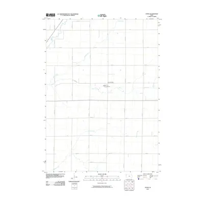
2010 Map of Oyens
USGS Topo · Published 2010About this map
Oyens serves as the primary focal point of this Plymouth County landscape, anchored by the Oyens Post Office and the nearby Saint Catherines Catholic Cemetery. The terrain is defined by a systematic agricultural grid and a series of waterways that carve through the prairie soil. The Floyd River touches the northwestern corner, while drainage systems like Willow Creek, Deep Creek, and Plymouth Creek dictate the local topography. This 2010 survey reflects a deeply organized rural environment where section roads such as Nature Ave, Noble Ave, and Otter Ave provide the framework for the region's homesteads and farms. The intersection of local county routes like c16 and c30 highlights the enduring importance of road transport in connecting this quiet corner of Iowa's farming country.
Find a feature on this map
24 named features on this map. Tap any name to fly to it.
Don’t see what you’re looking for? This feature index may not catch every label — zoom into the map to look around manually.
Map Details
Editions of this 2010 Oyens Map
This is the sole edition of this map. No revisions or reprints were ever made.
Other maps of this area

1954 · Fort Dodge
USGS Topo · 1:250,000

1955 · Sioux City
USGS Topo · 1:250,000

1957 · Fort Dodge
USGS Topo · 1:250,000

1958 · Sioux City
USGS Topo · 1:250,000

1958 · Fort Dodge
USGS Topo · 1:250,000

1959 · Sioux City
USGS Topo · 1:250,000

1962 · Le Mars
USGS Topo · 1:62,500

1962 · Union Center
USGS Topo · 1:62,500
1969 · Granville West
USGS Topo · 1:24,000
1969 · Remsen
USGS Topo · 1:24,000