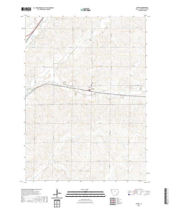
2022 Map of Oyens
USGS Topo · Published 2022About this map
The small village of Oyens occupies a central position on this Plymouth County landscape, situated at a junction of rail and roadway. This area of Northwest Iowa is defined by its agricultural grid, where a network of numbered section lines like 160th St and named avenues such as Otter Ave and Pioneer Ave segment the terrain. Just north of the settlement, Saint Catherines Cem serves as a significant local landmark for genealogical research. The topography is subtly shaped by the drainage patterns of Willow Cr, Deep Cr, and Plymouth Cr, which meander through the prairie soils. This 2022 survey documents the persistent rural character of the region, anchored by the transportation corridor of State Hwy 60 Bus in the northwest and a well-maintained system of county roads including Co Rd K64.
Find a feature on this map
27 named features on this map. Tap any name to fly to it.
Don’t see what you’re looking for? This feature index may not catch every label — zoom into the map to look around manually.
Map Details
Editions of this 2022 Oyens Map
This is the sole edition of this map. No revisions or reprints were ever made.
Other maps of this area

1954 · Fort Dodge
USGS Topo · 1:250,000

1955 · Sioux City
USGS Topo · 1:250,000

1957 · Fort Dodge
USGS Topo · 1:250,000

1958 · Sioux City
USGS Topo · 1:250,000

1958 · Fort Dodge
USGS Topo · 1:250,000

1959 · Sioux City
USGS Topo · 1:250,000

1962 · Le Mars
USGS Topo · 1:62,500

1962 · Union Center
USGS Topo · 1:62,500
1969 · Granville West
USGS Topo · 1:24,000
1969 · Remsen
USGS Topo · 1:24,000