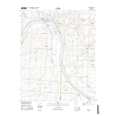
2017 Map of Ozark
USGS Topo · Published 2017About this map
Ozark and the winding Arkansas River define this portion of the Arkansas valley, where the landscape transitions between the river's floodplains and the surrounding hills. The city of Ozark is anchored by the Ozark Bridge, which spans the river to connect with South Ozark and Webb City. To the east, the map traces the early reaches of Lake Dardanelle, a vast waterway dotted with landforms like Guthrie Island, Honea Island, and Moores Island.
Find a feature on this map
136 named features on this map. Tap any name to fly to it.
Don’t see what you’re looking for? This feature index may not catch every label — zoom into the map to look around manually.
Map Details
Editions of this 2017 Ozark Map
This is the sole edition of this map. No revisions or reprints were ever made.
Other maps of this area

1879 · Cravens
USGS Topo · 1:62,500

1887 · Magazine Mountain #1
USGS Topo · 1:62,500

1887 · Magazine Mountain #2
USGS Topo · 1:62,500

1887 · Watalula
USGS Topo · 1:62,500

1887 · Magazine Mountain
USGS Topo · 1:62,500

1890 · Magazine Mountain
USGS Topo · 1:125,000

1906 · Batson
USGS Topo · 1:62,500

1939 · Watalula
USGS Topo · 1:62,500

1956 · Russellville
USGS Topo · 1:250,000

1961 · Coal Hill
USGS Topo · 1:24,000