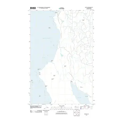
2011 Map of Ozette
USGS Topo · Published 2011About this map
The westernmost edges of the contiguous United States meet the Pacific Ocean on this coastal Washington map, where the shoreline is defined by dramatic geology and indigenous history. Cape Alava and the nearby Indian Village sit at the center of the coastal strip, illustrating the long-standing human connection to this maritime environment. Inland from the rocky coast, the landscape transitions into a series of open meadows, including Rooses Prairie, Ahlstroms Prairie, and Mannys Prairie, which break up the dense forested reaches of Olympic National Park.
Find a feature on this map
31 named features on this map. Tap any name to fly to it.
Don’t see what you’re looking for? This feature index may not catch every label — zoom into the map to look around manually.
Map Details
Editions of this 2011 Ozette Map
This is the sole edition of this map. No revisions or reprints were ever made.
Other maps of this area

1935 · Ozette Lake
USGS Topo · 1:62,500

1938 · Cape Flattery
USGS Topo · 1:62,500

1942 · Ozette Lake
USGS Topo · 1:62,500

1953 · Cape Flattery
USGS Topo · 1:250,000

1956 · Ozette Lake
USGS Topo · 1:62,500
1957 · Cape Flattery
USGS Topo · 1:62,500

1963 · Cape Flattery
USGS Topo · 1:250,000

1984 · Umbrella Creek
USGS Topo · 1:24,000
1984 · Ozette
USGS Topo · 1:24,000
1984 · Makah Bay
USGS Topo · 1:24,000