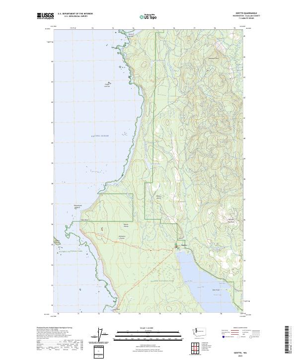
2023 Map of Ozette
USGS Topo · Published 2023About this map
Ozette serves as the gateway to this coastal wilderness, where the Pacific Ocean meets the western edge of the Olympic Peninsula. This 2023 survey documents a landscape defined by its remote prairies and significant landmarks, including the westernmost point of the contiguous United States at Cape Alava. Historic land use is evident in the naming of several coastal openings such as Ahlstroms Prairie, Rooses Prairie, and Männys Prairie, which provide distinct breaks in the forest cover. The map details a rugged coastline marked by Point of Arches to the north and Sand Point to the south, with prominent features like Ozette Island and Tskawahyah Island lying just offshore. Inland, the vast expanse of Ozette Lake dominates the southeast, fed by Umbrella Creek and Palmquist Creek, with the settlement of North End situated along its northern shores.
Find a feature on this map
40 named features on this map. Tap any name to fly to it.
Don’t see what you’re looking for? This feature index may not catch every label — zoom into the map to look around manually.
Map Details
Editions of this 2023 Ozette Map
This is the sole edition of this map. No revisions or reprints were ever made.
Other maps of this area

1935 · Ozette Lake
USGS Topo · 1:62,500

1938 · Cape Flattery
USGS Topo · 1:62,500

1942 · Ozette Lake
USGS Topo · 1:62,500

1953 · Cape Flattery
USGS Topo · 1:250,000

1956 · Ozette Lake
USGS Topo · 1:62,500
1957 · Cape Flattery
USGS Topo · 1:62,500

1963 · Cape Flattery
USGS Topo · 1:250,000

1984 · Umbrella Creek
USGS Topo · 1:24,000
1984 · Ozette
USGS Topo · 1:24,000
1984 · Makah Bay
USGS Topo · 1:24,000