
1956 Map of Ozette Lake
USGS Topo · Published 1960About this map
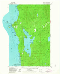
The coastal frontier of the Olympic Peninsula is documented here during the mid-1950s, centered on the expansive waters of Ozette Lake. This remote landscape is defined by the intersection of tribal heritage and early settler footprints, notably within the Ozette Indian Reservation where the Indian Village (Site) and Ozette Village are recorded. Inland, several prairie openings such as Rooses Prairie and Ahlstroms Prairie mark the locations of early homesteads and clearings in the dense forest.
Find a feature on this map
93 named features on this map. Tap any name to fly to it.
Don’t see what you’re looking for? This feature index may not catch every label — zoom into the map to look around manually.
Map Details
Editions of this 1956 Ozette Lake Map
4 editions found
Other maps of this area

1935 · Clallam
USGS Topo · 1:62,500

1935 · Ozette Lake
USGS Topo · 1:62,500

1935 · Lake Pleasant
USGS Topo · 1:62,500

1938 · Cape Flattery
USGS Topo · 1:62,500

1939 · Forks
USGS Topo · 1:62,500

1942 · Clallam
USGS Topo · 1:62,500

1942 · Ozette Lake
USGS Topo · 1:62,500

1942 · Lake Pleasant
USGS Topo · 1:62,500

1943 · Copalis Beach
USGS Topo · 1:250,000

1951 · Copalis Beach
USGS Topo · 1:250,000