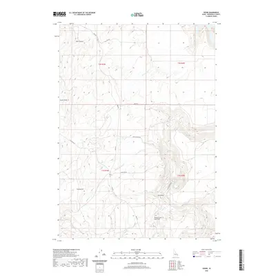
2020 Map of Ozone
USGS Topo · Published 2020About this map
Ozone sits at a high-elevation crossroads in Bonneville County, where the southern reaches of the Idaho landscape transition into volcanic features. The southeastern portion of the map is dominated by the Willow Creek Lava Field, a geologically distinct area drained by Willow Cr and Rock Cr. The terrain is defined by dramatic elevation changes, from the depths of Black Canyon in the north to the prominence of Peterson Hill in the west. A network of rural routes, including Bone Rd and Kapps Crossing Rd, connects the scattered topography of Euchre Valley and Dry Hollow. This survey captures a remote ranching and grazing environment where the water supply is managed through seasonal drainages like Badger Cr and Noon Cr, reflecting the land use patterns typical of the high Snake River Plain fringes.
Find a feature on this map
23 named features on this map. Tap any name to fly to it.
Don’t see what you’re looking for? This feature index may not catch every label — zoom into the map to look around manually.
Map Details
Editions of this 2020 Ozone Map
This is the sole edition of this map. No revisions or reprints were ever made.
Other maps of this area

1924 · Hell Creek
USGS Topo · 1:62,500

1924 · Ammon
USGS Topo · 1:62,500

1926 · Hell Creek
USGS Topo · 1:62,500

1948 · Ucon
USGS Topo · 1:24,000

1949 · Ucon
USGS Topo · 1:24,000

1950 · Rigby
USGS Topo · 1:62,500

1950 · Rigby SE
USGS Topo · 1:24,000

1951 · Rigby SE
USGS Topo · 1:24,000

1951 · Poplar
USGS Topo · 1:24,000

1955 · Driggs
USGS Topo · 1:250,000