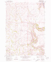
1981 Map of Ozone
USGS Topo · Published 1981About this map
Willow Creek meanders through the high country of Bonneville County, defining the drainage patterns of this 1981 topographic study. The settlement of Ozone serves as a central landmark in this high-altitude landscape, situated near a small Cem and the headwaters of Dry Hollow. To the north, the waters of Ririe Lake and Blacktail Creek mark the transition toward the Snake River plains, while the terrain is deeply incised by Black Canyon and various creek beds like Badger Creek and Rock Creek.
Find a feature on this map
22 named features on this map. Tap any name to fly to it.
Don’t see what you’re looking for? This feature index may not catch every label — zoom into the map to look around manually.
Map Details
Editions of this 1981 Ozone Map
This is the sole edition of this map. No revisions or reprints were ever made.
Other maps of this area

1924 · Hell Creek
USGS Topo · 1:62,500

1924 · Ammon
USGS Topo · 1:62,500

1926 · Hell Creek
USGS Topo · 1:62,500

1948 · Ucon
USGS Topo · 1:24,000

1949 · Ucon
USGS Topo · 1:24,000

1950 · Rigby
USGS Topo · 1:62,500

1950 · Rigby SE
USGS Topo · 1:24,000

1951 · Rigby SE
USGS Topo · 1:24,000

1951 · Poplar
USGS Topo · 1:24,000

1955 · Driggs
USGS Topo · 1:250,000