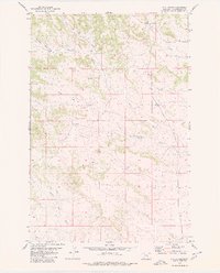
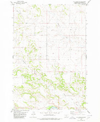
1980 Map of P K Ranch
USGS Topo · Published 1980About this map
P K Ranch and the surrounding ranchlands of Yellowstone County are documented in this 1980 survey, which highlights the importance of seasonal water sources and drainages in this cattle country. The landscape is defined by the branching systems of Dutch Oven Creek, Railroad Creek, and South Fork Creek. These names reflect the local lore and functional geography of the region, where features like Churn Dash Creek and Cow Gulch provided essential landmarks for navigators and ranchers alike. A single Corral and A Spring near the county's northern boundary mark specific points of utility in an otherwise open, dissected terrain. The map captures a moment in the late twentieth century when these rural expanses remained largely dedicated to traditional grazing, with few man-made structures beyond the primary ranch site and essential livestock facilities.
Find a feature on this map
13 named features on this map. Tap any name to fly to it.
Don’t see what you’re looking for? This feature index may not catch every label — zoom into the map to look around manually.
Map Details
Editions of this 1980 P K Ranch Map
This is the sole edition of this map. No revisions or reprints were ever made.
Other maps of this area

1954 · Roundup
USGS Topo · 1:250,000

1958 · Roundup
USGS Topo · 1:250,000

1979 · Roundup
USGS Topo · 1:100,000
1980 · P K Ranch NE
USGS Topo · 1:24,000
1980 · Steamboat Butte
USGS Topo · 1:24,000

1980 · Cherry Spring
USGS Topo · 1:24,000

1980 · Dunn Mountain South
USGS Topo · 1:24,000
1980 · Cotton Creek
USGS Topo · 1:24,000

1980 · Dunn Mountain North
USGS Topo · 1:24,000
1980 · P K Ranch SE
USGS Topo · 1:24,000