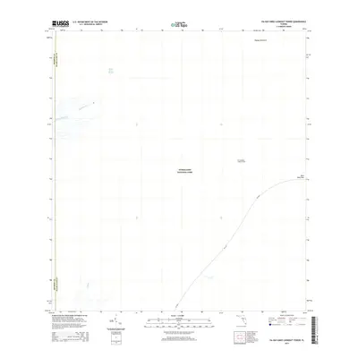
2015 Map of Pa-Hay-Okee Lookout Tower
USGS Topo · Published 2015About this map
Everglades National Park dominates this landscape, revealing a delicate hydrologic system at the border of Monroe and Miami-Dade counties. The central feature is the Shark River Slough, a slow-moving sheet of water that sustains the region's biodiversity. To the west, the headwaters of the N River and the meandering Rookery Branch flow toward the coast, while solitary elevated features like Papaya Hammock rise above the wetlands. The only significant infrastructure is the SR-9336 corridor, which leads visitors to Rock Reef Pass and the Pa-Hay-Okee Lookout Tower. This vantage point provides a critical window into the transition between the freshwater slough and the surrounding marl prairies and cypress forests during the early 21st century.
Find a feature on this map
10 named features on this map. Tap any name to fly to it.
Don’t see what you’re looking for? This feature index may not catch every label — zoom into the map to look around manually.
Map Details
Editions of this 2015 Pa-Hay-Okee Lookout Tower Map
This is the sole edition of this map. No revisions or reprints were ever made.
Other maps of this area

1956 · Miami
USGS Topo · 1:250,000

1958 · Miami
USGS Topo · 1:250,000

1972 · Whitewater Bay East
USGS Topo · 1:24,000

1972 · Mahogany Hammock
USGS Topo · 1:24,000

1972 · Taylor Slough
USGS Topo · 1:24,000

1972 · Long Pine Key
USGS Topo · 1:24,000

1972 · Panther Mound
USGS Topo · 1:24,000

1972 · Tarpon Bay
USGS Topo · 1:24,000

1972 · Indian Camp Creek
USGS Topo · 1:24,000

1972 · Pa Hay Okee Lookout Tower
USGS Topo · 1:24,000