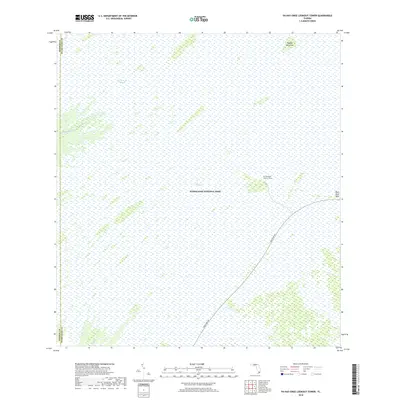
2018 Map of Pa-Hay-Okee Lookout Tower
USGS Topo · Published 2018About this map
Everglades National Park dominates this section of South Florida, where the sheet captures the unique hydrology of the river of grass. The landscape is defined by the broad Shark River Slough, a slow-moving sheet of water punctuated by tree islands like Papaya Hammock. Human infrastructure is minimal, represented primarily by the Main Park Rd which bisects the southeastern corner. This road provides access to the Pa-Hay-Okee Lookout Tower, a critical vantage point for observing the vast sawgrass prairies. To the west, the headwaters of the Rookery Branch and the Shark River emerge from the wetlands. The map also delineates the boundary between Monroe and Miami-Dade counties, showing how this protected wilderness spans administrative lines.
Find a feature on this map
10 named features on this map. Tap any name to fly to it.
Don’t see what you’re looking for? This feature index may not catch every label — zoom into the map to look around manually.
Map Details
Editions of this 2018 Pa-Hay-Okee Lookout Tower Map
This is the sole edition of this map. No revisions or reprints were ever made.
Other maps of this area

1956 · Miami
USGS Topo · 1:250,000

1958 · Miami
USGS Topo · 1:250,000

1972 · Whitewater Bay East
USGS Topo · 1:24,000

1972 · Mahogany Hammock
USGS Topo · 1:24,000

1972 · Taylor Slough
USGS Topo · 1:24,000

1972 · Long Pine Key
USGS Topo · 1:24,000

1972 · Panther Mound
USGS Topo · 1:24,000

1972 · Tarpon Bay
USGS Topo · 1:24,000

1972 · Indian Camp Creek
USGS Topo · 1:24,000

1972 · Pa Hay Okee Lookout Tower
USGS Topo · 1:24,000