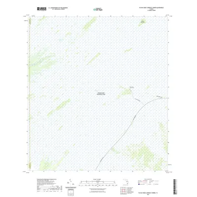
2021 Map of Pa-Hay-Okee Lookout Tower
USGS Topo · Published 2021About this map
Shark River Slough dominates this landscape, showing the complex hydrology of Everglades National Park in the early 21st century. The map centers on the Pa-Hay-Okee Lookout Tower, a key observation point accessible via Pa-Hay-Okee Road off the Main Park Road. The vast freshwater marsh is punctuated by tree islands known as hammocks, including the named Papaya Hammock to the north. This survey illustrates the delicate interface of moving water and elevation, where features like Rock Reef Pass and drainage channels such as Rookery Branch define the flow toward the coast. The absence of traditional settlements or townships underscores the protected status of this wilderness area within The Everglades.
Find a feature on this map
11 named features on this map. Tap any name to fly to it.
Don’t see what you’re looking for? This feature index may not catch every label — zoom into the map to look around manually.
Map Details
Editions of this 2021 Pa-Hay-Okee Lookout Tower Map
This is the sole edition of this map. No revisions or reprints were ever made.
Other maps of this area

1956 · Miami
USGS Topo · 1:250,000

1958 · Miami
USGS Topo · 1:250,000

1972 · Whitewater Bay East
USGS Topo · 1:24,000

1972 · Mahogany Hammock
USGS Topo · 1:24,000

1972 · Taylor Slough
USGS Topo · 1:24,000

1972 · Long Pine Key
USGS Topo · 1:24,000

1972 · Panther Mound
USGS Topo · 1:24,000

1972 · Tarpon Bay
USGS Topo · 1:24,000

1972 · Indian Camp Creek
USGS Topo · 1:24,000

1972 · Pa Hay Okee Lookout Tower
USGS Topo · 1:24,000