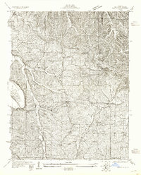
1930 Map of Pacific SE
USGS Topo · Published 1955About this map
The Big River winds through the western edge of Jefferson County, defining a landscape of narrow ridges and creek bottoms as surveyed in 1930. Small upland communities like Goldman and Highland are documented here, connected by early thoroughfares such as Hillsboro Road and May Ferry Road. The presence of Oak Hill Sch and Hillsboro Sch reflects the decentralized rural school system of the era, where one-room houses served local farm families. Numerous watercourses, including Cedar Creek, Sandy Creek, and Heads Creek, dissect the terrain, indicating the historical importance of drainage and natural boundaries for property lines and travel routes in this part of Missouri.
Find a feature on this map
17 named features on this map. Tap any name to fly to it.
Don’t see what you’re looking for? This feature index may not catch every label — zoom into the map to look around manually.
Map Details
Editions of this 1930 Pacific SE Map
2 editions found
Other maps of this area

1901 · De Soto
USGS Topo · 1:125,000

1912 · Kimmswick
USGS Topo · 1:62,500

1915 · Crystal City
USGS Topo · 1:62,500

1916 · Kimmswick
USGS Topo · 1:62,500

1930 · De Soto NE
USGS Topo · 1:24,000

1930 · Pacific SE
USGS Topo · 1:24,000

1931 · Pacific NE
USGS Topo · 1:24,000

1937 · Pacific
USGS Topo · 1:24,000

1937 · Fletcher
USGS Topo · 1:24,000

1938 · Cedar Hill
USGS Topo · 1:24,000