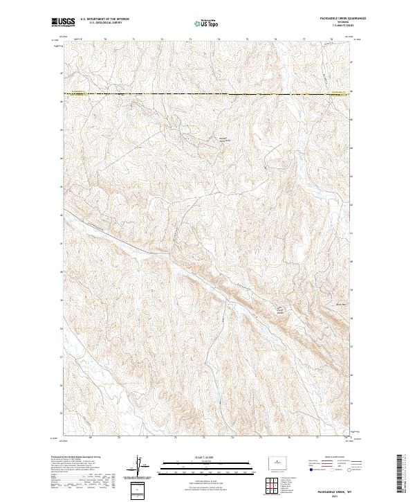
2021 Map of Packsaddle Creek
USGS Topo · Published 2021About this map
Black Mtn stands as a prominent topographical anchor in this high-desert landscape, located along the border of Washakie and Hot Springs counties. The terrain is defined by a series of drainage systems, including the headwaters of Lake Cr and Mud Cr, which intersect at the Lake Creek Divide. This area in north-central Wyoming represents a classic high-plains watershed where seasonal watercourses like Cottonwood Cr and Gardner Cr carve deep draws through the arid landscape. The road network, including Black Mountain Rd and Mud Creek Rd, suggests a remote region primarily utilized for ranching or resource management, tracing the natural contours of the ridges and valley floors. Further north, the Murphy Dome Draw illustrates the complex erosion patterns characteristic of the Big Horn Basin's eastern margins.
Find a feature on this map
20 named features on this map. Tap any name to fly to it.
Don’t see what you’re looking for? This feature index may not catch every label — zoom into the map to look around manually.
Map Details
Editions of this 2021 Packsaddle Creek Map
This is the sole edition of this map. No revisions or reprints were ever made.
Other maps of this area

1952 · Rathbun Ranch
USGS Topo · 1:24,000

1952 · Bull Mountain
USGS Topo · 1:24,000

1955 · Arminto
USGS Topo · 1:250,000

1957 · Rathbun Ranch
USGS Topo · 1:24,000

1958 · Arminto
USGS Topo · 1:250,000

1960 · Coyote Hill
USGS Topo · 1:24,000
1960 · Blue Hill
USGS Topo · 1:24,000

1960 · Packsaddle Creek
USGS Topo · 1:24,000

1962 · Arminto
USGS Topo · 1:250,000
1966 · Zimmerman Buttes
USGS Topo · 1:24,000