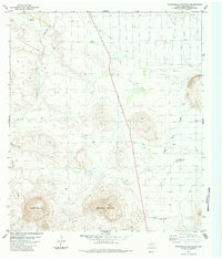
1983 Map of Packsaddle Mountain
USGS Topo · Published 1984About this map
Packsaddle Mountain and Panther Mountain dominate this Chihuahuan Desert landscape in Brewster County, Texas, as it appeared in the mid-1970s and early 1980s. The region is defined by ephemeral drainage systems like Terlingua Creek, Alamo de Cesario Cr, and Nine Point Draw, which cut through the arid terrain. While human infrastructure is sparse, the map documents a Mine on the southern slopes of Packsaddle Mountain and a remote Landing Strip to the north, suggesting the importance of aviation for reaching these isolated ranchlands and geologic sites. Vital water sources are specifically identified, including the Cheosa Waterhole and a solitary Water Tank, highlighting the essential landmarks for navigation and survival in this high-elevation desert environment east of the Christmas Mountains.
Find a feature on this map
13 named features on this map. Tap any name to fly to it.
Don’t see what you’re looking for? This feature index may not catch every label — zoom into the map to look around manually.
Map Details
Editions of this 1983 Packsaddle Mountain Map
2 editions found
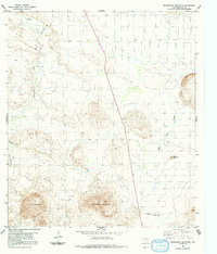
Other maps of this area

1903 · Chisos Mountains
USGS Topo · 1:125,000

1903 · Terlingua
USGS Topo · 1:125,000

1904 · Terlingua
USGS Topo · 1:125,000

1905 · Chisos Mountains
USGS Topo · 1:125,000

1917 · Agua Fria
USGS Topo · 1:62,500

1918 · Bone Spring
USGS Topo · 1:125,000

1918 · Nine Point Mesa
USGS Topo · 1:62,500

1937 · Nine Point Mesa
USGS Topo · 1:62,500

1937 · Agua Fria
USGS Topo · 1:62,500

1959 · Emory Peak
USGS Topo · 1:250,000