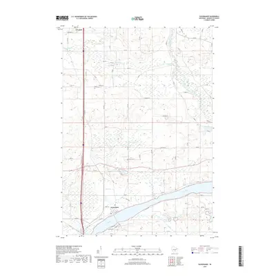
2018 Map of Packwaukee
USGS Topo · Published 2018About this map
The Fox River and its associated wetlands dominate this central Wisconsin landscape, which is defined by the village of Packwaukee and the southern edge of Westfield. The river’s winding course is mirrored by the Mad River and numerous tributaries such as Klawitter Cr and Ox Creek, creating a complex network of marshes and basins including Lake Emery, Pollus Lake, and Bright Lake. This water-rich environment has shaped local infrastructure, with roads like Co Rd C and Co Rd D navigating the low-lying terrain.
Find a feature on this map
71 named features on this map. Tap any name to fly to it.
Don’t see what you’re looking for? This feature index may not catch every label — zoom into the map to look around manually.
Map Details
Editions of this 2018 Packwaukee Map
This is the sole edition of this map. No revisions or reprints were ever made.
Other maps of this area

1902 · Portage
USGS Topo · 1:62,500

1902 · Briggsville
USGS Topo · 1:62,500

1957 · Madison
USGS Topo · 1:250,000

1958 · Briggsville
USGS Topo · 1:62,500

1960 · Madison
USGS Topo · 1:250,000

1961 · Oxford
USGS Topo · 1:62,500

1961 · Montello
USGS Topo · 1:62,500

1962 · Portage
USGS Topo · 1:62,500
1975 · Briggsville
USGS Topo · 1:24,000
1979 · Westfield West
USGS Topo · 1:24,000