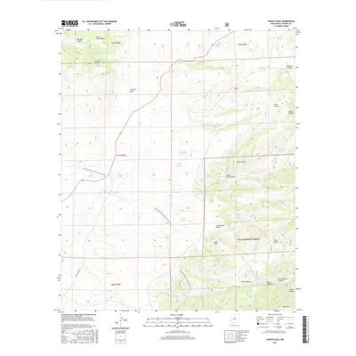
2017 Map of Paddys Hole
USGS Topo · Published 2017About this map
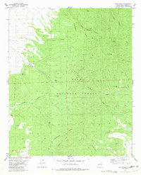
The Continental Divide National Scenic Trail winds through the high-elevation terrain of the Gila National Forest, crossing a landscape defined by significant canyons and draws. This high-country region is dominated by the Luera Mountains and the Black Range, where water management is central to the land's utility. Numerous named tanks, such as Ofaro Tank and Upper Duck Tank, are scattered across the terrain to capture runoff for livestock or wildlife, while Lonesome Well provides a localized water source in the remote canyons. The map tracks the passage through the Paddys Hole area, revealing how transportation and ranching infrastructure like Pueblo Ranch Rd follow the natural contours of landmarks like School Section Draw and Corduroy Draw. This 2017 survey serves as a modern record of one of the more secluded sections of the Continental Divide.
Find a feature on this map
55 named features on this map. Tap any name to fly to it.
Don’t see what you’re looking for? This feature index may not catch every label — zoom into the map to look around manually.
Map Details
Editions of this 2017 Paddys Hole Map
This is the sole edition of this map. No revisions or reprints were ever made.
Other maps of this area

1954 · Tularosa
USGS Topo · 1:250,000

1958 · Tularosa
USGS Topo · 1:250,000

1965 · Oak Peak
USGS Topo · 1:24,000

1965 · Dusty
USGS Topo · 1:24,000

1965 · Wahoo Peak
USGS Topo · 1:24,000

1979 · San Mateo Mountains
USGS Topo · 1:100,000
1981 · Mojonera Canyon
USGS Topo · 1:24,000
1981 · Luera Mountains East
USGS Topo · 1:24,000
1981 · Paddys Hole
USGS Topo · 1:24,000
1981 · Wahoo Peak
USGS Topo · 1:24,000