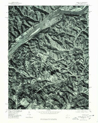
1976 Map of Paden City
USGS Topo · Published 1979About this map
Paden City and the surrounding riverfront settlements are documented in this mid-1970s orthophotograph, which provides a photographic perspective of the Ohio River valley. The imagery reveals the industrial and residential grid of Paden City as it sits tight against the riverbanks, contrasted by the steep, wooded hillsides that dominate the interior of the quadrangle. To the south, the northern edge of Sistersville is visible, while across the water in Ohio, the small community of Sardis overlooks the river's bend. This 1976 aerial survey shows the landscape before significant modern changes, tracing the winding path of Middle Island Creek as it meanders through the southern portion of the map. The orthophoto format allows for the direct observation of field patterns, road networks, and land use during this period.
Find a feature on this map
6 named features on this map. Tap any name to fly to it.
Don’t see what you’re looking for? This feature index may not catch every label — zoom into the map to look around manually.
Map Details
Editions of this 1976 Paden City Map
This is the sole edition of this map. No revisions or reprints were ever made.
Other maps of this area

1905 · West Union
USGS Topo · 1:62,500

1905 · New Matamoras
USGS Topo · 1:62,500

1906 · Saint Marys
USGS Topo · 1:62,500

1906 · New Martinsville
USGS Topo · 1:62,500

1924 · St Marys
USGS Topo · 1:62,500

1924 · New Martinsville
USGS Topo · 1:62,500

1924 · New Matamoras
USGS Topo · 1:62,500

1924 · West Union
USGS Topo · 1:62,500

1926 · New Martinsville
USGS Topo · 1:62,500

1926 · New Matamoras
USGS Topo · 1:62,500