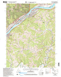
2002 Map of Paden City
USGS Topo · Published 2006About this map
Paden City and Sistersville anchor this industrial and natural corridor along the Ohio River at the dawn of the 21st century. The map illustrates a complex landscape where the Ohio River Railroad follows the water's edge, passing through tight-knit river settlements and the protected habitats of the Ohio River Islands National Wildlife Refuge, including Paden Island and Williamson Island. Steep ridges like Starkey Ridge and Thomas Ridge define the interior, where a network of narrow hollows and runs, such as Pursley Creek and Point Pleasant Fork, dictate the placement of rural homesteads and family landmarks.
Find a feature on this map
70 named features on this map. Tap any name to fly to it.
Don’t see what you’re looking for? This feature index may not catch every label — zoom into the map to look around manually.
Map Details
Editions of this 2002 Paden City Map
This is the sole edition of this map. No revisions or reprints were ever made.
Other maps of this area

1905 · West Union
USGS Topo · 1:62,500

1905 · New Matamoras
USGS Topo · 1:62,500

1906 · Saint Marys
USGS Topo · 1:62,500

1906 · New Martinsville
USGS Topo · 1:62,500

1924 · St Marys
USGS Topo · 1:62,500

1924 · New Martinsville
USGS Topo · 1:62,500

1924 · New Matamoras
USGS Topo · 1:62,500

1924 · West Union
USGS Topo · 1:62,500

1926 · New Martinsville
USGS Topo · 1:62,500

1926 · New Matamoras
USGS Topo · 1:62,500