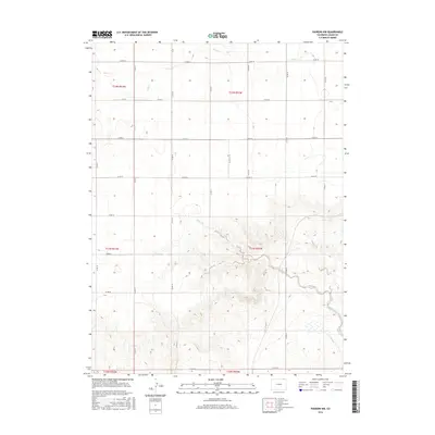
2016 Map of Padroni NW
USGS Topo · Published 2016About this map
Cow Cr and Lewis Creek dominate the drainage patterns of this high plains landscape in Logan County, where the township and range system has established a rigid grid of agricultural roads. These routes, including Co Rd 78 and Co Rd 74, delineate large tracts of land typical of the Colorado plains. The map reveals a transition from the relatively flat terrain in the north to the more dissected drainage areas surrounding Lewis Cr further south. This 2016 survey documents the enduring spatial logic of the Public Land Survey System, showing how the rural road network follows sectional boundaries like t12n r53w and t11n r52w. For the local historian or geographer, the map provides a clear view of the modern rural infrastructure and water management within this agricultural corridor.
Find a feature on this map
18 named features on this map. Tap any name to fly to it.
Don’t see what you’re looking for? This feature index may not catch every label — zoom into the map to look around manually.
Map Details
Editions of this 2016 Padroni NW Map
This is the sole edition of this map. No revisions or reprints were ever made.
Other maps of this area

1951 · Iliff
USGS Topo · 1:24,000

1951 · Padroni NW
USGS Topo · 1:24,000

1952 · Padroni
USGS Topo · 1:24,000

1953 · Peetz
USGS Topo · 1:24,000

1954 · Sterling
USGS Topo · 1:250,000

1954 · Scottsbluff
USGS Topo · 1:250,000

1958 · Scottsbluff
USGS Topo · 1:250,000

1958 · Sterling
USGS Topo · 1:250,000

1972 · Easterly Airport
USGS Topo · 1:24,000

1972 · Lorenzo
USGS Topo · 1:24,000