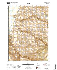
2020 Map of Page Springs
USGS Topo · Published 2020About this map
Blitzen Valley defines the western portion of this landscape, where the Donner und Blitzen River flows through a managed corridor of hydrology. The reliance on water management in this arid region of Harney County is evident through the extensive network of irrigation and storage, including the Eastside Canal and Bridge Cr Canal. These engineered waterways sit alongside a series of upland catchment basins such as Bridge Cr Reservoir Number One and Bridge Cr Reservoir Number Two, illustrating the complex effort to harness seasonal runoff for the valley floor.
Find a feature on this map
30 named features on this map. Tap any name to fly to it.
Don’t see what you’re looking for? This feature index may not catch every label — zoom into the map to look around manually.
Map Details
Editions of this 2020 Page Springs Map
This is the sole edition of this map. No revisions or reprints were ever made.
Other maps of this area

1955 · Adel
USGS Topo · 1:250,000

1957 · Adel
USGS Topo · 1:250,000

1958 · Adel
USGS Topo · 1:250,000

1962 · Adel
USGS Topo · 1:250,000

1967 · Krumbo Reservoir
USGS Topo · 1:24,000

1967 · Roaring Springs
USGS Topo · 1:24,000

1967 · Frenchglen
USGS Topo · 1:24,000
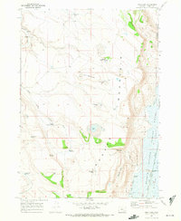
1967 · Irish Lake
USGS Topo · 1:24,000

1967 · Page Springs
USGS Topo · 1:24,000

1968 · Tombstone Canyon
USGS Topo · 1:24,000