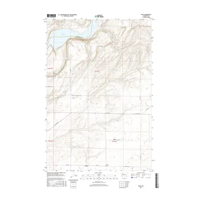
2017 Map of Page
USGS Topo · Published 2017About this map
Lake Sacajawea and the winding Snake River define the northern boundary of this agricultural region where Franklin Co and Walla Walla Co meet. The map documents a rural landscape transition from the river bluffs to the expansive Eureka Flat in the south, a terrain marked by small settlements including Page, Adkins, and Hatch. Local infrastructure is characterized by a network of named county roads like Ice Harbor Dr and Adkins Rd that connect isolated homesteads and farms. Of particular interest to local researchers is the concentration of orchards and residential development near the river, evidenced by clusterings of roads like Granny Smith Loop, Gala Dr, and Fuji Dr, which speak to the area's contemporary fruit-growing industry and agricultural heritage.
Find a feature on this map
30 named features on this map. Tap any name to fly to it.
Don’t see what you’re looking for? This feature index may not catch every label — zoom into the map to look around manually.
Map Details
Editions of this 2017 Page Map
This is the sole edition of this map. No revisions or reprints were ever made.
Other maps of this area

1915 · Wallulah
USGS Topo · 1:96,000

1918 · Wallula
USGS Topo · 1:125,000

1953 · Walla Walla
USGS Topo · 1:250,000

1958 · Walla Walla
USGS Topo · 1:250,000

1964 · Levey SE
USGS Topo · 1:24,000

1964 · Slater
USGS Topo · 1:24,000

1964 · Levey NE
USGS Topo · 1:24,000

1966 · Page
USGS Topo · 1:24,000

1966 · Snake River
USGS Topo · 1:24,000

1966 · Rulo
USGS Topo · 1:24,000