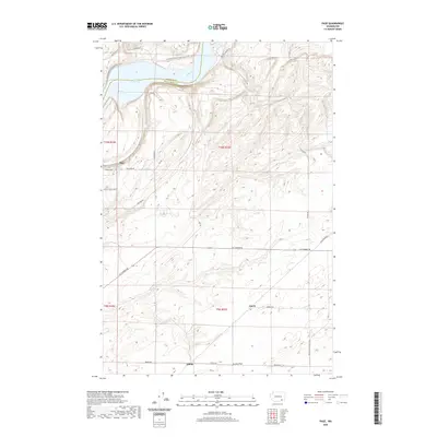
2020 Map of Page
USGS Topo · Published 2020About this map
Lake Sacajawea and the winding Snake River define the northern border of this Walla Walla County landscape, marking the boundary with Franklin County. The topography is characterized by the broad expanse of Eureka Flat in the south, while the northern sections feature the dramatic slopes of the river canyon. This modern survey illustrates a region largely defined by its rural transportation network and recreational corridors, notably the Columbia Plateau State Park Trail which follows the river's path. Small settlements like Page are connected by a web of local routes including Ice Harbor Dr, Adkins Rd, and Fish Hook Rd. The map provides a clear view of the area's transition from the high plateau down to the water's edge, highlighting the infrastructure of agricultural access and river management near the Ice Harbor Dam area.
Find a feature on this map
28 named features on this map. Tap any name to fly to it.
Don’t see what you’re looking for? This feature index may not catch every label — zoom into the map to look around manually.
Map Details
Editions of this 2020 Page Map
This is the sole edition of this map. No revisions or reprints were ever made.
Other maps of this area

1915 · Wallulah
USGS Topo · 1:96,000

1918 · Wallula
USGS Topo · 1:125,000

1953 · Walla Walla
USGS Topo · 1:250,000

1958 · Walla Walla
USGS Topo · 1:250,000

1964 · Levey SE
USGS Topo · 1:24,000

1964 · Slater
USGS Topo · 1:24,000

1964 · Levey NE
USGS Topo · 1:24,000

1966 · Page
USGS Topo · 1:24,000

1966 · Snake River
USGS Topo · 1:24,000

1966 · Rulo
USGS Topo · 1:24,000