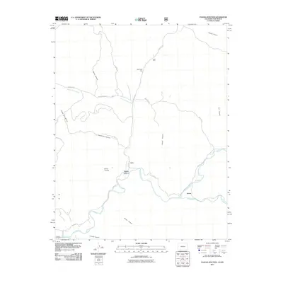
2011 Map of Pagosa Junction
USGS Topo · Published 2011About this map
The confluence of the San Juan River and Navajo River anchors this landscape in the southern reaches of Archuleta County, where the settlement of Pagosa Junction and nearby Gato represent historical crossroads. The terrain is deeply carved by water, featuring prominent landforms like Monte Camado and the gap at Cat Creek Gap. A complex network of drainage systems, including Cañada de la Nutrita, Garcia Canyon, and Conejo Canyon, defines the movement of both water and the local road systems such as Trujillo Rd.
Find a feature on this map
31 named features on this map. Tap any name to fly to it.
Don’t see what you’re looking for? This feature index may not catch every label — zoom into the map to look around manually.
Map Details
Editions of this 2011 Pagosa Junction Map
This is the sole edition of this map. No revisions or reprints were ever made.
Other maps of this area

1889 · Largo
USGS Topo · 1:250,000

1895 · Largo
USGS Topo · 1:250,000

1924 · Pagosa Springs
USGS Topo · 1:125,000

1927 · Pagosa Springs
USGS Topo · 1:125,000

1945 · Durango
USGS Topo · 1:250,000

1953 · Durango
USGS Topo · 1:250,000

1954 · Durango
USGS Topo · 1:250,000

1954 · Carracas
USGS Topo · 1:24,000

1954 · Aztec
USGS Topo · 1:250,000

1957 · Pagosa Junction
USGS Topo · 1:62,500