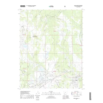
2019 Map of Pagosa Springs
USGS Topo · Published 2019About this map
The San Juan River flows through the heart of Pagosa Springs in this recent survey, anchoring a landscape where mountain wilderness meets growing high-altitude settlements. The town center is densely mapped, showing the Archuleta County Courthouse and nearby Hot Springs, while suburban developments like Sunetha Flats expand toward the west. To the north, the San Juan National Forest covers the terrain, marked by a complex network of winter trails and ATV routes such as Plumtaw Winter (Snow) and the Cade Mountain ATV trail. Significant water management and recreational features are evident across the quadrangle, including Lake Pagosa, Lake Hatcher, and Stevens Reservoir. These reservoirs, along with various irrigation ditches like Fourmile Ditch and Mesa Ditch, illustrate the vital role of water infrastructure in this mountain community. The presence of Stevens Field and Hilltop Cem provide further points of interest for local historians.
Find a feature on this map
136 named features on this map. Tap any name to fly to it.
Don’t see what you’re looking for? This feature index may not catch every label — zoom into the map to look around manually.
Map Details
Editions of this 2019 Pagosa Springs Map
This is the sole edition of this map. No revisions or reprints were ever made.
Other maps of this area

1913 · Summitville
USGS Topo · 1:125,000

1915 · Summitville
USGS Topo · 1:125,000

1924 · Pagosa Springs
USGS Topo · 1:125,000

1927 · Pagosa Springs
USGS Topo · 1:125,000

1945 · Durango
USGS Topo · 1:250,000

1953 · Durango
USGS Topo · 1:250,000

1954 · Durango
USGS Topo · 1:250,000

1957 · Chromo
USGS Topo · 1:62,500

1957 · Wolf Creek Pass
USGS Topo · 1:62,500

1957 · Pagosa Junction
USGS Topo · 1:62,500