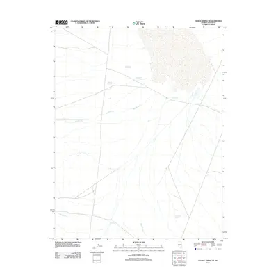
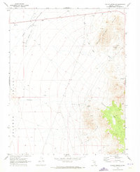
2012 Map of Pahroc Spring NE
USGS Topo · Published 2012About this map
Bristol Lake Number One, Bristol Lake Number Three, and Bristol Lake Number Four define the northern hydrology of this high-desert landscape in Lincoln County. These features, along with several artificial catchments like Mustang Reservoir and Cliff Reservoir, suggest a land managed for water resources in an arid environment. The map shows a network of desert drainage patterns, most notably the wide paths of Boulder Wash, Miller Wash, and Red Rock Wash that cut across the territory. A more permanent water source is indicated at Long Point Spring in the southeastern quadrant, while Point of Rock Reservoir marks a specific point of collection to the south. The terrain is largely defined by these intermittent watercourses and the infrastructure required to capture seasonal moisture for local use.
Find a feature on this map
10 named features on this map. Tap any name to fly to it.
Don’t see what you’re looking for? This feature index may not catch every label — zoom into the map to look around manually.
Map Details
Editions of this 2012 Pahroc Spring NE Map
This is the sole edition of this map. No revisions or reprints were ever made.
Other maps of this area

1885 · Pioche
USGS Topo · 1:250,000

1886 · Pioche
USGS Topo · 1:250,000

1916 · Highland
USGS Topo · 1:62,500

1918 · Highland
USGS Topo · 1:62,500

1954 · Caliente
USGS Topo · 1:250,000

1959 · Caliente
USGS Topo · 1:250,000
1970 · The Bluffs
USGS Topo · 1:24,000
1970 · Pahroc Summit Pass
USGS Topo · 1:24,000
1970 · Deadman Spring SE
USGS Topo · 1:24,000
1970 · Pahroc Spring SE
USGS Topo · 1:24,000