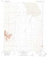
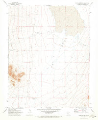
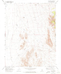
1970 Map of Pahroc Spring NE
USGS Topo · Published 1983About this map
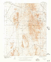
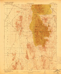
Dry Lake (Depression) dominates the central topography of this high-desert landscape in Lincoln County. The environment is defined by its drainage patterns and water management, featuring catchments like Mustang Reservoir and the Point of Rock Reservoir to the south. An Aqueduct traces along the eastern foothills, signaling the critical infrastructure required to sustain activity in this arid basin. Beyond these engineered features, the natural terrain is marked by Boulder Wash, while a lone Corral indicates the presence of ranching operations within the vast desert reaches. The numerous benchmarks, such as BM 4810, provide precise elevation data across the shifting contours of the valley floor and rising slopes.
Find a feature on this map
16 named features on this map. Tap any name to fly to it.
Don’t see what you’re looking for? This feature index may not catch every label — zoom into the map to look around manually.
Map Details
Editions of this 1970 Pahroc Spring NE Map
2 editions found
Other maps of this area

1885 · Pioche
USGS Topo · 1:250,000

1886 · Pioche
USGS Topo · 1:250,000
1916 · Highland
USGS Topo · 1:62,500
1918 · Highland
USGS Topo · 1:62,500

1954 · Caliente
USGS Topo · 1:250,000

1959 · Caliente
USGS Topo · 1:250,000
1970 · The Bluffs
USGS Topo · 1:24,000
1970 · Pahroc Summit Pass
USGS Topo · 1:24,000
1970 · Deadman Spring SE
USGS Topo · 1:24,000
1970 · Pahroc Spring SE
USGS Topo · 1:24,000