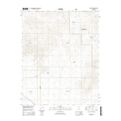
2014 Map of Pahrump NE
USGS Topo · Published 2014About this map
Toiyabe National Forest dominates the high-elevation terrain of the northeast Pahrump valley, where the steep eastern slopes of the Spring Mountains descend toward the desert floor. This 2014 survey documents the rugged drainage systems that define the area's geography, most notably Carpenter Canyon and Lee Spring Canyon. The map records a sharp ecological and administrative transition where the protected forest lands meet the open Mojave Desert. Access into this high-country landscape is traced via Carpenter Canyon Rd, which serves as a primary artery for those navigating the boundary between Nye and Clark counties. The cartography emphasizes the complex topography of the range, showing the intricate contour patterns that define these canyons before they reach the alluvial fans below.
Find a feature on this map
12 named features on this map. Tap any name to fly to it.
Don’t see what you’re looking for? This feature index may not catch every label — zoom into the map to look around manually.
Map Details
Editions of this 2014 Pahrump NE Map
This is the sole edition of this map. No revisions or reprints were ever made.
Other maps of this area

1907 · Las Vegas
USGS Topo · 1:250,000

1908 · Las Vegas
USGS Topo · 1:250,000

1954 · Las Vegas
USGS Topo · 1:250,000

1957 · Las Vegas
USGS Topo · 1:250,000

1957 · Mt. Stirling
USGS Topo · 1:62,500

1957 · Charleston Peak
USGS Topo · 1:62,500

1957 · Mountain Springs
USGS Topo · 1:62,500
1958 · Pahrump
USGS Topo · 1:62,500

1959 · Las Vegas
USGS Topo · 1:250,000

1962 · Las Vegas
USGS Topo · 1:250,000