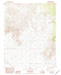
1984 Map of Pahrump NE
USGS Topo · Published 1984About this map
The Spring Mountains dominate this 1984 survey, revealing a landscape defined by dramatic drainage systems and early infrastructure. Topographic detail highlights the steep descents of Lee Canyon, Carpenter Canyon, and Trout Canyon, which carve through the high elevations of Clark County. A Borrow Pit in the southwest indicates localized extraction efforts, likely related to the maintenance of the various 4wd routes that thread through the high desert terrain. This provisional edition also tracks a Wooden Power Transmission Line cutting across the lower slopes, a specific technological marker of the era's utility distribution. The map serves as a precise record of these mountain corridors before more modern development reached further into the rugged interior of the range.
Find a feature on this map
10 named features on this map. Tap any name to fly to it.
Don’t see what you’re looking for? This feature index may not catch every label — zoom into the map to look around manually.
Map Details
Editions of this 1984 Pahrump NE Map
This is the sole edition of this map. No revisions or reprints were ever made.
Other maps of this area

1907 · Las Vegas
USGS Topo · 1:250,000

1908 · Las Vegas
USGS Topo · 1:250,000

1954 · Las Vegas
USGS Topo · 1:250,000

1957 · Las Vegas
USGS Topo · 1:250,000

1957 · Mt. Stirling
USGS Topo · 1:62,500

1957 · Charleston Peak
USGS Topo · 1:62,500

1957 · Mountain Springs
USGS Topo · 1:62,500
1958 · Pahrump
USGS Topo · 1:62,500

1959 · Las Vegas
USGS Topo · 1:250,000

1962 · Las Vegas
USGS Topo · 1:250,000