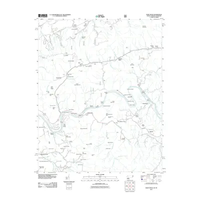
2011 Map of Paint Rock
USGS Topo · Published 2011About this map
The French-Broad-River carves a central path through this landscape, creating significant geographic features like Weaver Bend and Huff Island. The river's influence on local infrastructure is evident in river crossings such as the Upper Twin Bridge, Lower Twin Bridge, and Wolf Creek Bridge. These connections linked small riverside communities like Lanceville and Paint Rock during a period of modern development near the North Carolina-Tennessee border.
Find a feature on this map
135 named features on this map. Tap any name to fly to it.
Don’t see what you’re looking for? This feature index may not catch every label — zoom into the map to look around manually.
Map Details
Editions of this 2011 Paint Rock Map
This is the sole edition of this map. No revisions or reprints were ever made.
Other maps of this area

1883 · Morristown
USGS Topo · 1:125,000

1892 · Greeneville
USGS Topo · 1:125,000

1893 · Mt Guyot
USGS Topo · 1:125,000

1893 · Morristown
USGS Topo · 1:125,000

1894 · Asheville
USGS Topo · 1:125,000

1895 · Morristown
USGS Topo · 1:125,000

1896 · Greeneville
USGS Topo · 1:125,000

1901 · Asheville
USGS Topo · 1:125,000

1904 · Greeneville
USGS Topo · 1:125,000

1912 · Mt Guyot
USGS Topo · 1:125,000