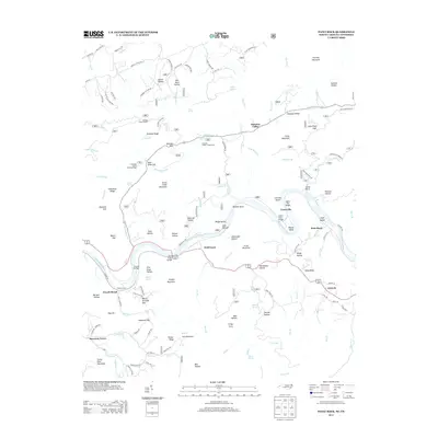
2013 Map of Paint Rock
USGS Topo · Published 2013About this map
The French Broad River carves a deep path through this landscape on the Tennessee and North Carolina border, defining the settlement patterns of Lanceville and Paint Rock. This mountainous terrain is marked by narrow hollows and high ridges, where local life once centered around river crossings like Grooms Bridge and the Wolf Creek Bridge. Higher elevations are home to the Meadow Creek Lookout and the Houston Valley Campground, illustrating a shift from early river-based economies to contemporary forest recreation. Genealogists and historians can trace several small communities, including Harmony Grove and Antioch, alongside landmarks like Briggs Island and Buffalo Rock. The intricate naming of the landscape, from Gold Mine Ridge to Peach Orchard Gap, reflects generations of land use and extraction in the southern Appalachian highlands.
Find a feature on this map
130 named features on this map. Tap any name to fly to it.
Don’t see what you’re looking for? This feature index may not catch every label — zoom into the map to look around manually.
Map Details
Editions of this 2013 Paint Rock Map
This is the sole edition of this map. No revisions or reprints were ever made.
Other maps of this area

1883 · Morristown
USGS Topo · 1:125,000

1892 · Greeneville
USGS Topo · 1:125,000

1893 · Mt Guyot
USGS Topo · 1:125,000

1893 · Morristown
USGS Topo · 1:125,000

1894 · Asheville
USGS Topo · 1:125,000

1895 · Morristown
USGS Topo · 1:125,000

1896 · Greeneville
USGS Topo · 1:125,000

1901 · Asheville
USGS Topo · 1:125,000

1904 · Greeneville
USGS Topo · 1:125,000

1912 · Mt Guyot
USGS Topo · 1:125,000