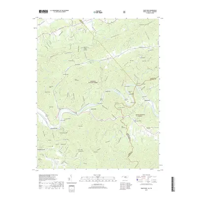
2019 Map of Paint Rock
USGS Topo · Published 2019About this map
The French Broad River carves a deep path through the southern Appalachian borderlands, marking the divide between the Cherokee National Forest and Pisgah National Forest. This terrain is defined by its complex ridge-and-hollow topography, where small settlements like Lanceville, Wolf Creek, and Paint Rock are situated along the river's winding course. The map documents the persistent agricultural and social footprint in this vertical landscape, with family burial grounds such as Moore Cem, Jones Cem, and Justis Cem positioned near the scattered homesteads.
Find a feature on this map
136 named features on this map. Tap any name to fly to it.
Don’t see what you’re looking for? This feature index may not catch every label — zoom into the map to look around manually.
Map Details
Editions of this 2019 Paint Rock Map
This is the sole edition of this map. No revisions or reprints were ever made.
Other maps of this area

1883 · Morristown
USGS Topo · 1:125,000

1892 · Greeneville
USGS Topo · 1:125,000

1893 · Mt Guyot
USGS Topo · 1:125,000

1893 · Morristown
USGS Topo · 1:125,000

1894 · Asheville
USGS Topo · 1:125,000

1895 · Morristown
USGS Topo · 1:125,000

1896 · Greeneville
USGS Topo · 1:125,000

1901 · Asheville
USGS Topo · 1:125,000

1904 · Greeneville
USGS Topo · 1:125,000

1912 · Mt Guyot
USGS Topo · 1:125,000