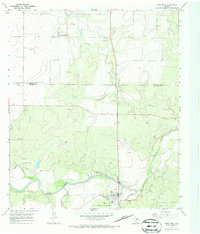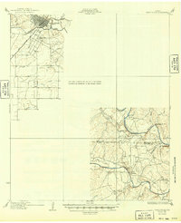
1932 Map of Paint Rock
USGS Topo · Published 1949About this map
The confluence of the Concho River and the Colorado River highlights this early twentieth-century survey of the West Texas landscape. The city of Ballinger serves as a primary rail hub, situated where the Gulf Colorado and Santa Fe Ry crosses the Colorado. To the south, the settlement of Concho rests near the river's banks, while the surrounding tablelands are marked by family-named bluffs and local school districts. The distribution of South Ward Sch, Dry Ridge Sch, Mapes Sch, and Currie Sch reveals the rural community structure of the era, reflecting a time when local schoolhouses served as the social anchors for farming and ranching families scattered between Fuzzy Cr and Sand Creek. Landmarks like Deadmans Bluff and Brushy Bluff provide distinct topographical reference points along the winding river valleys.
Find a feature on this map
24 named features on this map. Tap any name to fly to it.
Don’t see what you’re looking for? This feature index may not catch every label — zoom into the map to look around manually.
Map Details
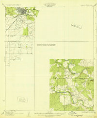
Editions of this 1932 Paint Rock Map
2 editions found
Historical Maps of Ballinger Through Time
7 maps found