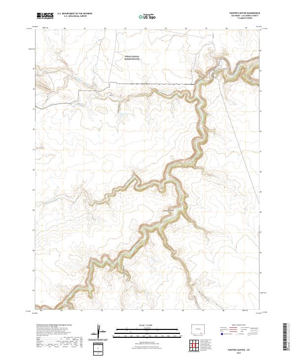
2022 Map of Painted Canyon
USGS Topo · Published 2022About this map
The Purgatoire River carves a winding path through this corner of Las Animas County, defining a landscape of deep-cut drainages and dramatic elevation changes. The waterway creates the significant Purgatoire Canyon and Painted Canyon systems, which dominate the central and eastern portions of the map. Unlike the more open plains to the north, this area is characterized by numerous tributary canyons, including Kiowa Canyon and Trementina Canyon, suggesting a complex geological history shaped by centuries of erosion.
Find a feature on this map
21 named features on this map. Tap any name to fly to it.
Don’t see what you’re looking for? This feature index may not catch every label — zoom into the map to look around manually.
Map Details
Editions of this 2022 Painted Canyon Map
This is the sole edition of this map. No revisions or reprints were ever made.
Other maps of this area

1891 · Mesa De Maya
USGS Topo · 1:125,000

1892 · Elmoro
USGS Topo · 1:125,000

1893 · Elmoro
USGS Topo · 1:125,000

1893 · Mesa de Maya
USGS Topo · 1:125,000

1897 · Elmoro
USGS Topo · 1:125,000

1954 · Trinidad
USGS Topo · 1:250,000

1955 · La Junta
USGS Topo · 1:250,000

1955 · Trinidad
USGS Topo · 1:250,000

1958 · La Junta
USGS Topo · 1:250,000

1958 · Trinidad
USGS Topo · 1:250,000