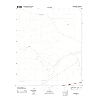
2012 Map of Painted Gorge
USGS Topo · Published 2012About this map
The Old Overland Stage Rte traces a historic path across the northern reaches of this Colorado Desert landscape, anchoring a map defined by arid drainage systems and expansive plateaus. To the east, the flat expanse of West Mesa rises above the surrounding terrain, while the namesake Painted Gorge marks a significant topographical break to the west. This area is characterized by a network of seasonal watercourses, including the wide Coyote Wash and Palm Canyon Wash, which dictate the local geography. Modern access is represented by Evan Hewes Hwy and a series of secondary routes like Painted Gorge Rd and Munson Ln, which connect the desert floor to the rugged interior trails such as the Munson Trl.
Find a feature on this map
13 named features on this map. Tap any name to fly to it.
Don’t see what you’re looking for? This feature index may not catch every label — zoom into the map to look around manually.
Map Details
Editions of this 2012 Painted Gorge Map
This is the sole edition of this map. No revisions or reprints were ever made.
Other maps of this area

1915 · El Centro
USGS Topo · 1:125,000

1931 · Carrizo
USGS Topo · 1:125,000

1939 · Jacumba
USGS Topo · 1:62,500

1940 · Plaster City
USGS Topo · 1:62,500

1940 · Coyote Wells
USGS Topo · 1:62,500

1942 · El Centro
USGS Topo · 1:250,000

1942 · Carrizo Mtn
USGS Topo · 1:62,500

1942 · Jacumba
USGS Topo · 1:62,500

1943 · Coyote Wells
USGS Topo · 1:62,500

1944 · Plaster City
USGS Topo · 1:62,500