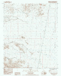
1985 Map of Painted Rock Wash
USGS Topo · Published 1985About this map
Little Piute Mountains and the Old Woman Mountains frame a stark desert landscape where seasonal drainages dictate the geography of the mid-1980s. This drainage network, including the expansive Big Wash and Ward Valley, highlights how water moves through this arid basin toward the east. The presence of the Copper King Mine and Oro Plata Mine, alongside numerous unnamed prospects, indicates a legacy of mineral exploration in the high ground near Pilot Peak.
Find a feature on this map
14 named features on this map. Tap any name to fly to it.
Don’t see what you’re looking for? This feature index may not catch every label — zoom into the map to look around manually.
Map Details
Editions of this 1985 Painted Rock Wash Map
This is the sole edition of this map. No revisions or reprints were ever made.
Other maps of this area

1942 · Amboy
USGS Topo · 1:250,000

1943 · Center Hills
USGS Topo · 1:62,500

1943 · Amboy
USGS Topo · 1:250,000

1943 · Essex
USGS Topo · 1:62,500

1943 · Turtle Mts.
USGS Topo · 1:62,500

1954 · Needles
USGS Topo · 1:250,000

1954 · Turtle Mountains
USGS Topo · 1:62,500

1956 · Needles
USGS Topo · 1:250,000

1956 · Milligan
USGS Topo · 1:62,500

1956 · Essex
USGS Topo · 1:62,500