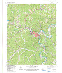
2022 Map of Paintsville
USGS Topo · Published 2022About this map
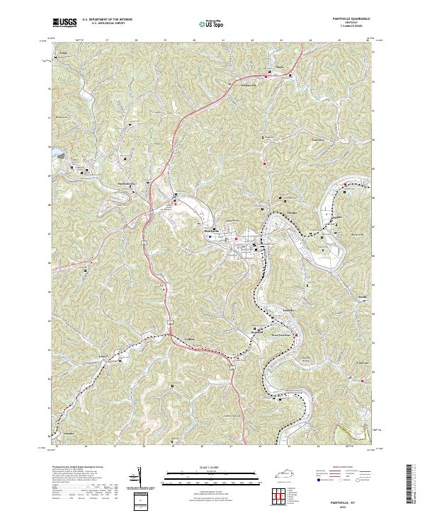
Paintsville serves as the central hub of this Johnson County landscape, where the waters of Paint Creek meet the Levisa Fork. The terrain is defined by a dense network of hollows and ridges, including landmarks like Rocky Knob and Cannel Coal Gap, which shaped the development of surrounding communities such as Staffordsville, Thealka, and Van Lear. The area's transit history is visible in the route of the Dawkins Line Rail-Trl, which traces the path of former industrial rail corridors through Hagerhill and Denver.
Find a feature on this map
103 named features on this map. Tap any name to fly to it.
Don’t see what you’re looking for? This feature index may not catch every label — zoom into the map to look around manually.
Map Details
Editions of this 2022 Paintsville Map
This is the sole edition of this map. No revisions or reprints were ever made.
Historical Maps of Van Lear Through Time
7 maps found