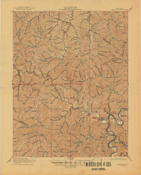
1917 Map of Paintsville
USGS Topo · Published 1945About this map
Paintsville serves as the focal point of this Eastern Kentucky landscape during the first World War, situated where Paint Creek meets the meandering river. The map documents a dense network of mountain communities and industrial connections, notably the Kentucky River and Northland RR serving the coal-rich valleys. Small settlements like Van Lear and West Van Lear are clearly established, while the rural interior is dotted with a systematic numbered school system, from School No 1 to School No 19.
Find a feature on this map
124 named features on this map. Tap any name to fly to it.
Don’t see what you’re looking for? This feature index may not catch every label — zoom into the map to look around manually.
Map Details
Editions of this 1917 Paintsville Map

Other maps of this area

1886 · Prestonsburg
USGS Topo · 1:125,000

1889 · Salyersville
USGS Topo · 1:125,000

1891 · Salyersville
USGS Topo · 1:125,000

1892 · Prestonsburg
USGS Topo · 1:125,000

1899 · Salyersville
USGS Topo · 1:125,000

1903 · Kenova
USGS Topo · 1:125,000

1904 · Kenova
USGS Topo · 1:125,000

1911 · Louisa
USGS Topo · 1:48,000

1913 · Louisa
USGS Topo · 1:62,500

1914 · Laynesville
USGS Topo · 1:48,000