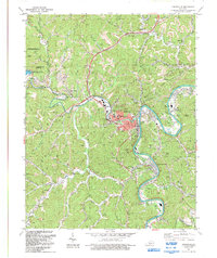
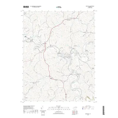
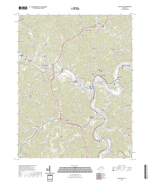
1971 Map of Paintsville
USGS Topo · Published 1978About this map
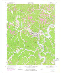
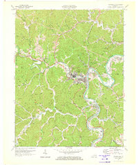
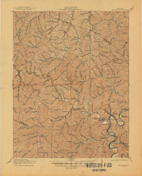
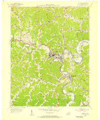
Paintsville serves as the focal point of this Eastern Kentucky landscape, situated where Paint Creek meets the winding Levisa Fork. The terrain is characterized by a dense network of hollows and ridges, with smaller settlements like Thealka, Thelma, and Staffordsville following the valley floors. Significant industrial and transit infrastructure is evident, specifically the Chesapeake and Ohio railroad corridor that snakes alongside the river. The presence of the Filtration Plant and the State Hospital near the town center points to the area's development as a regional hub. Local family history is well-preserved through numerous small burials such as Vanhose Cem and Butler Cem, while the Drive-in Theater and Golf Course reflect the mid-century social landscape. Higher elevations are marked by Rocky Knob and Bettys Knob, overlooking a landscape dotted with gas wells and coal interests, including a notable Strip Mine near Tutor Key.
Find a feature on this map
46 named features on this map. Tap any name to fly to it.
Don’t see what you’re looking for? This feature index may not catch every label — zoom into the map to look around manually.
Map Details
Editions of this 1971 Paintsville Map
2 editions found
Historical Maps of Paintsville Through Time
11 maps found

1915 Paintsville
Johnson County, KY
1917 Paintsville
Johnson County, KY
1954 Paintsville
Johnson County, KY

1962 Paintsville
Johnson County, KY
1971 Paintsville
Johnson County, KY
1992 Paintsville
Johnson County, KY
2010 Paintsville
Johnson County, KY
2013 Paintsville
Johnson County, KY
2016 Paintsville
Johnson County, KY
2019 Paintsville
Johnson County, KY
2022 Paintsville
Johnson County, KY