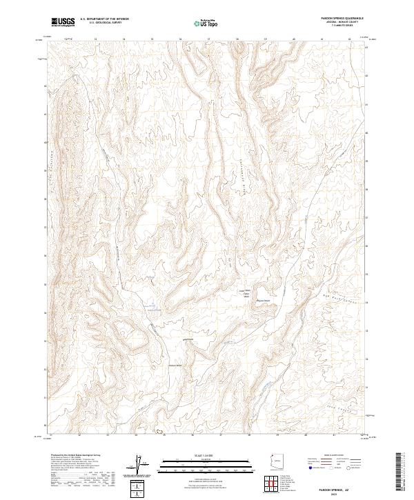
2023 Map of Pakoon Springs
USGS Topo · Published 2023About this map
Pakoon Spring and the nearby Pakoon Tank serve as critical water points in this arid reach of the Mojave Desert. Located within the Grand Canyon - Parashant National Monument, the landscape is defined by its dramatic drainage systems and ridge lines. The map reveals a network of canyons and washes, including the prominent Grand Wash and Cedar Wash, which cut through the high desert floor.
Find a feature on this map
21 named features on this map. Tap any name to fly to it.
Don’t see what you’re looking for? This feature index may not catch every label — zoom into the map to look around manually.
Map Details
Editions of this 2023 Pakoon Springs Map
This is the sole edition of this map. No revisions or reprints were ever made.
Other maps of this area

1886 · Saint Thomas
USGS Topo · 1:250,000

1886 · Mt. Trumbull
USGS Topo · 1:250,000

1892 · Mt. Trumbull
USGS Topo · 1:250,000

1893 · Saint Thomas
USGS Topo · 1:250,000

1926 · Bonelli
USGS Topo · 1:96,000

1953 · Gold Butte
USGS Topo · 1:62,500

1953 · Grand Canyon
USGS Topo · 1:250,000

1954 · Las Vegas
USGS Topo · 1:250,000

1954 · Littlefield 3 SW
USGS Topo · 1:24,000
1954 · Littlefield 3 SE
USGS Topo · 1:24,000